
Description

During the development of the software, special focus was put on a user friendly interface and simplicity of use, the variety of visualization facilities, and accounting for a priori data. Numerous variants of borehole and other geological data mapping are included. Depending on the interpreter’s idea of the cross- section type, programs give the user an option to choose specific data interpretation algorithms. Easy-to-use control systems allow the user to choose from the great number of equivalent results which are geophysically or geologically valid.
The user-friendly, intuitive interface and wide range of data presentation options allow geological problems to be solved with maximum efficiency. All ZOND programs are built using the same principle. Therefore, by mastering one you will easily be able to work with the other programs. Programs “understand” each other, which allows to interchange data from different methods between the programs, promoting a more holistic approach to data interpretation.
ZOND Software Package for data processing, analysis and interpretation
Potential Methods:
| ZondMag2D | 2D gravity and magnetic data interpretation (versions Ground, Airborne) |
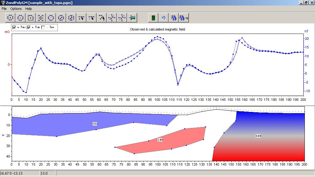
| ZondPGM | 2D gravity and magnetic data interpretation in polygonal way |
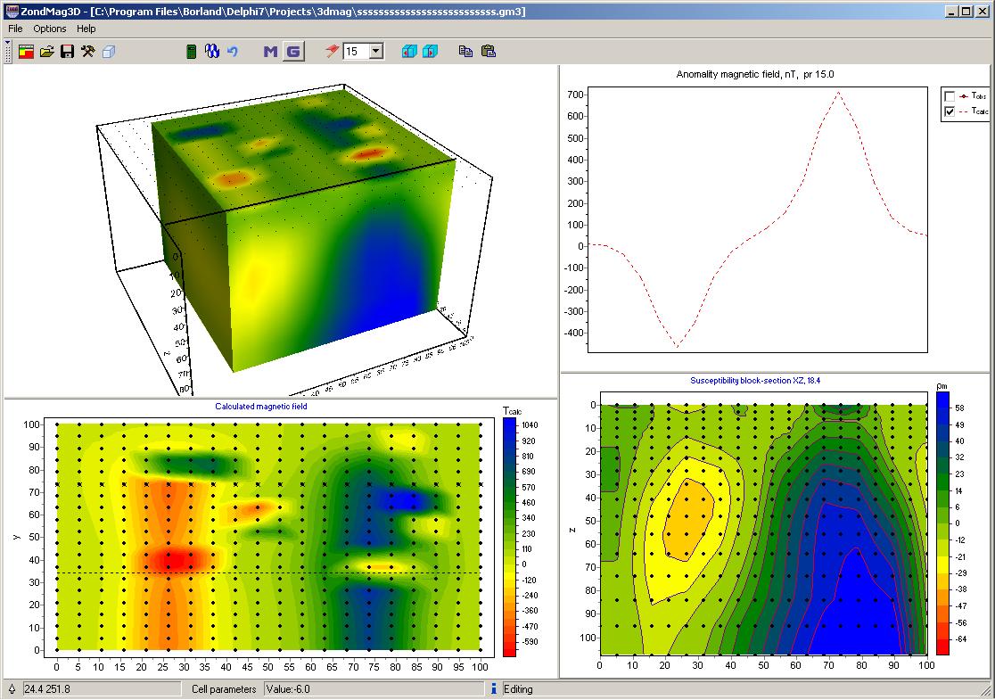
| ZondMag3D | 3D gravity and magnetic data interpretation |
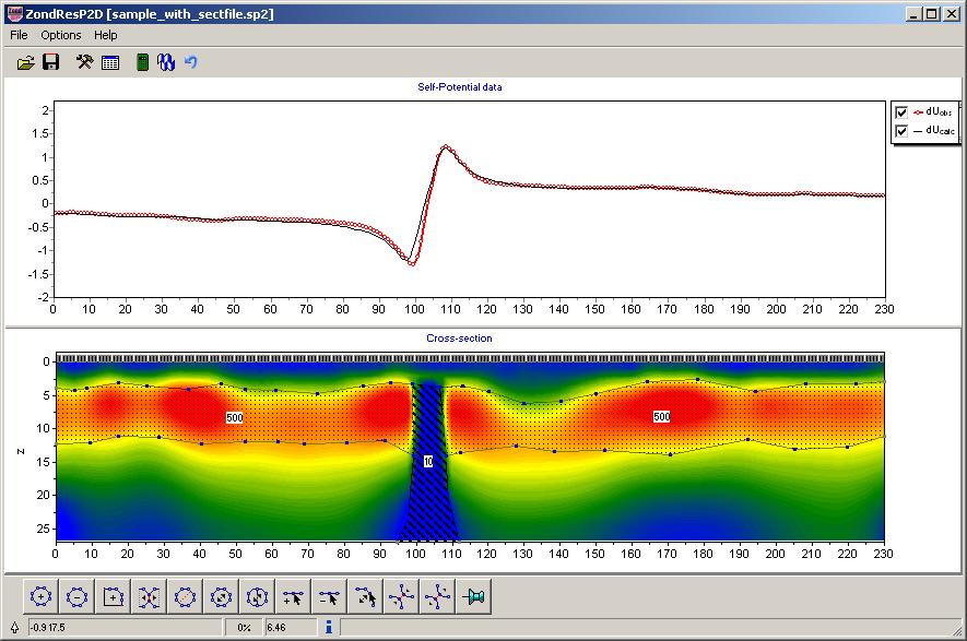
| ZondSP2D | 2D electric self-potential data interpretation |
| ZondSP2Dp | 2D electric self-potential data interpretation in polygonal way |
ELECTROMAGNETIC METHODS:
Geometrical EM Sounding and Profiling:
| ZCGViewer | Calculation and visualization of electric resistivity profiling graphic maps and apparent resistivity maps (for different arrays) |
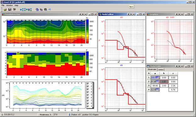
| ZondIP1D | VES and VES-IP 1D data interpretation |
| ZondHED1D | VES 1D data interpretation with induction effect calculation |
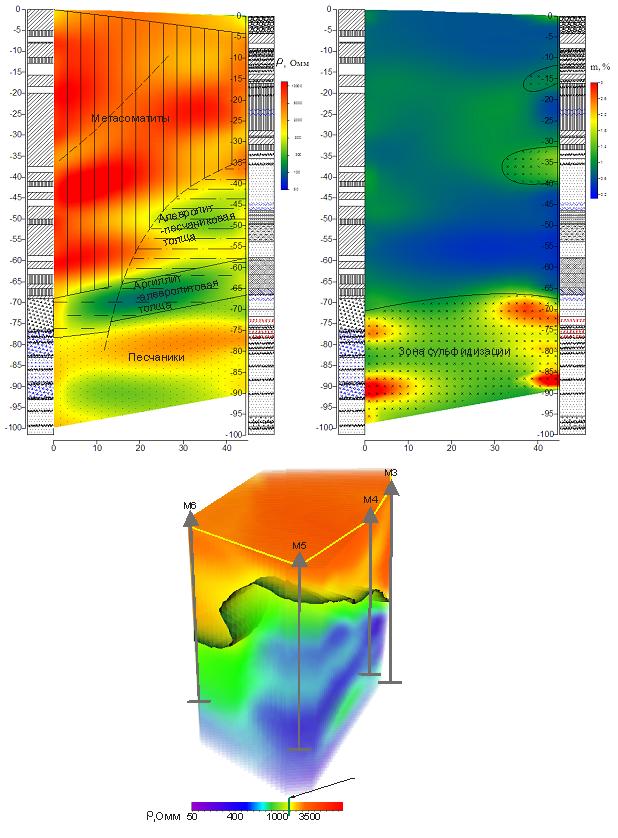
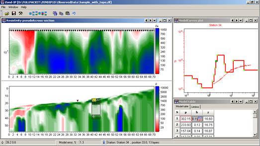
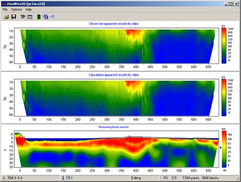
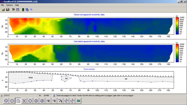
| ZondRes2D | Resistivity + IP 2D data interpretation (versions Land, Marine, Borehole) |
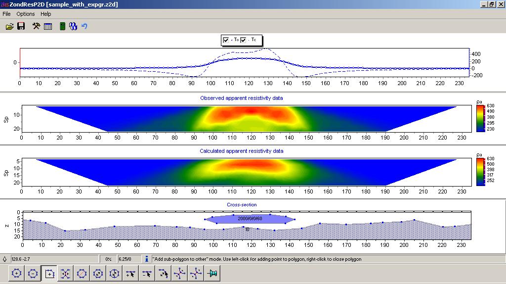
| ZondRes2Dp | Resistivity + IP 2D data interpretation in polygonal way (versions Land and Borehole) |
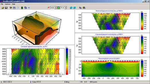
| ZondRes3D | Resistivity + IP 3D data interpretation (versions Land, Marine, Borehole) |
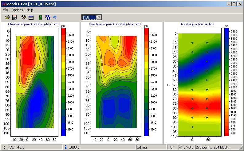
| ZondCHT | Resistivity, IP and EM logging 2D data interpretation (specialized for borehole measurements) |
Induction EM Sounding:
Natural Source:
| ZondMT1D | MT (AMT, RMT) 1D data interpretation |
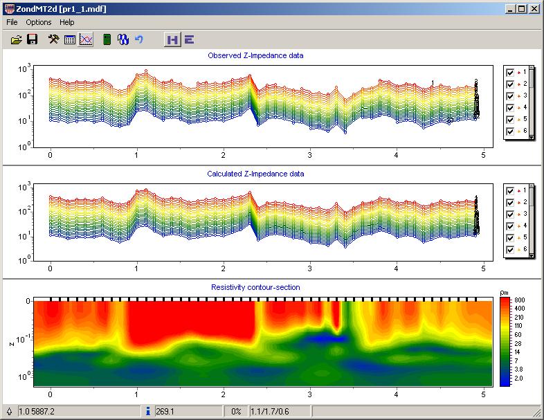
| ZondMT2D | MT (AMT, RMT) 2D data interpretation |
Control Source (Frequency Domain):
| ZondVMD1d | FDEM sounding with vertical magnetic source dipole 1D data interpretation |
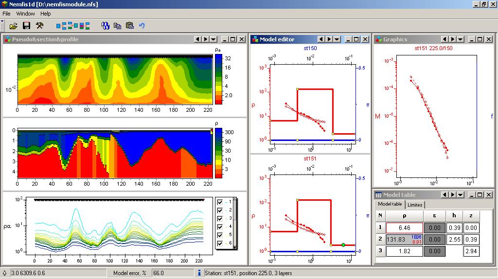
| Nemfis1D | Electromagnetic scanner (Nemfis) 1D data interpretation |
Control Source (Time Domain):
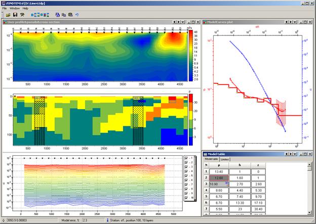
| ZondTEM1D | TDEM sounding 1D data interpretation for source loop and electric dipole |
SEISMIC:
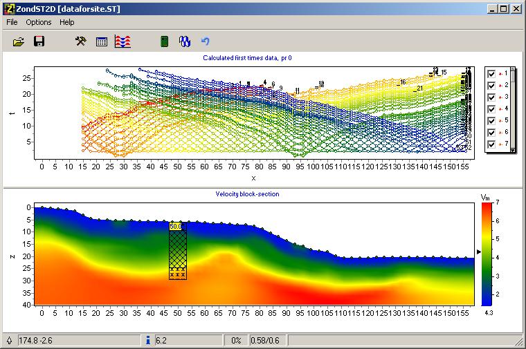
| ZondST2D | Seismotomography 2D data interpretation |
| ZondST3D | Seismotomography 3D data interpretation |
SPECIAL SOFTWARE:
| SectionEditor | Software for geological –geophysical section creation |
| BHEditor | The software for lithological columns creation |
| Z3DModView | Software for 3D visualization of 2D inversion results |

Reviews
There are no reviews yet.