Description
- Supports monochromatic, panchromatic, three- and multi-channel multispectral imagery.
- Supports scanned aerial film, matrix and push-broom digital airborne cameras, small- and medium-format metric cameras, close-range imagers, orthophotos, RPC satellites, LiDAR, UAS imagery and synthetic aperture radar.
- Imports third-party softcopy and pre-processed UAS projects, aerotriangulation results and other orientation files for quick setup.
- Full range of manual and automatic image orientation capabilities.
- Digitizes 3D vectors directly into AutoCAD, MicroStation, ArcGIS or Global Mapper using DAT/EM’s Capture interface.
- Robust and easy-to-use interface for maximum productivity.
- Bird’s-eye, close-up, project overview, 3D vector split window and multiple viewports offer a variety of visualization and feedback tools.
- Ability to apply coordinate transformation.
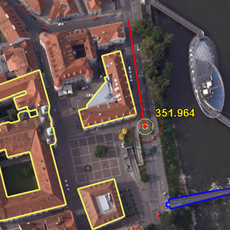
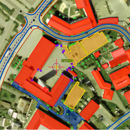
- Unlimited zoom levels, fast pan and automatic loading of adjacent stereo models with DAT/EM SuperImposition of CAD and GIS vectors over the image view.
- DAT/EM Ortho+Mosaic module for easy and precise creation of orthomosaics.
- Terrain Visualizer tool for dynamic, real-time preview of contours while DTM and breakline objects are created and edited.
- Contour Creator™ for creating and writing the finished contours to the CAD file.
- Interface to the DAT/EM-PCI ProPack to allow use of PCI Geomatica GDB data. (Requires PCI license)
- Airfield3D™ standards-compliant airspace obstruction mapping tool.
Point Translator for importing, regridding and converting point data, including LiDAR and other DTM features. - Several licensing levels from Professional to Mobile available.
Project Management
Summit Evolution’s project-based information management employs Microsoft-compliant windows and dialogue boxes that provide easy access to any location on any model. Summit Evolution provides the user with tools to manage large bundle-adjusted projects as well as smaller projects consisting of single stereo pairs. Users can roam seamlessly throughout an entire bundle-adjusted project as well as a single stereo model.
Orientation
Summit Evolution offers interior, relative, and absolute orientation tools. It also imports exterior orientation files and the results of third-party aerotriangulation. Summit Evolution easily opens Inpho MatchAT and supports the following aerotriangulation packages: Albany, PATB, Aerosys, BLUH, and BINGO. In addition, it can make projects and use pixel-to-ground solutions for Leica ADS40/80/100 Airborne Sensors, satellites with RPC (Rational Polynomial Coefficient), IfSAR (Interferometric synthetic aperture radar,) Sensor, and orthophotos. It offers tools to convert orthophotos with DEM files to stereo pairs and LiDAR files to orthophotos with stereo pairs. It can adjust and epipolarize satellite RPC imagery.
Interior Orientation:
Interior orientation transforms scanned pixel coordinates into photo coordinates. Summit Evolution includes the option to perform either manual or automatic interior orientation. With automatic interior, a fiducial patch may only be measured one time per camera. This means that if all of your projects use the same camera, you’ll never have to measure the fiducial patch again. Simply open the project and process with one click in the auto interior dialogue box.
Relative Orientation:
Relative orientation aligns the two images of a stereo pair so that they can be viewed in stereo. This can be done with either manual or automatic relative orientation. The manual procedure is simple and easy to use, featuring an auto align command and other options that make even the manual relative orientation into a semiautomatic process.
Absolute Orientation:
Absolute orientation creates three-dimensional ground coordinates within relatively oriented stereo pairs.
Exterior Orientation:
Exterior orientation creates three dimensional ground coordinates without the need to perform relative and absolute orientations. Exterior orientation works by importing exterior orientation parameters (X,Y,Z, omega, phi, kappa) from files such as those derived from the Applanix POSAVTM system or from aerotriangulation packages. An import wizard provides easy access to a multitude of file formats.
Subpixel
Summit Evolution improves vector data accuracy by removing pixel limitations. The system provides subpixel viewing functionality for measuring, dynamic zooming, and movement within pixels.
Image Sources
The Summit Evolution stereoplotter allows for easy management of multiple model images along with their appropriate camera and control files in a project-based environment. Quick and efficient stereoscopic orientation of the models is performed using either interior, relative, and absolute orientation or by employing exterior orientation data.
Summit projects may be created from virtually any source of stereo imagery: scanned aerial film, matrix and push-broom digital airborne sensors, small- and medium-format metric cameras, close-range terrestrial digital and scanned film sensors, synthetic stereo from orthophoto and DEM, synthetic aperture radar, LiDAR, and satellite sources. Projects from third-party systems may be imported and used directly as Summit Evolution projects.
Image Manipulation
Image tiling offers real-time panning and zooming. With its ability to load only the parts of the image that are currently being viewed, Summit Evolution provides the same level of performance regardless of image size. Summit Evolution also has the same memory requirements regardless of image size.
Additionally, Summit Evolution offers on-the-fly image adjustments and histogram equalization.
Summit Evolution can use many common and not-so-common image formats, either directly or by converting them to tiled GeoTiff. It supports the newer true 16-bit formats such as BigTiff and Jpeg 2000, which allow large files to exceed 4GB in size.
GUI Elements
Summit Evolution features customizable toolbars, menus, dockable bird’s-eye and close-up views for quick reference of location within a model, and an easy-to-use project management window and project overview tool.


Reviews
There are no reviews yet.