Description
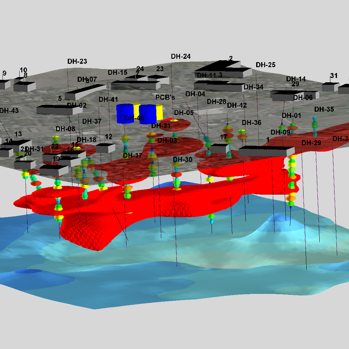
RockWorks is the standard in the petroleum, environmental, geotechnical and mining industries for surface and subsurface data visualization, with popular tools such as maps, logs, cross sections, fence diagrams, solid models and volume calculations.
RockWorks offers numerous options for analyzing your surface and subsurface data, and accepts many different data types, such as stratigraphy, lithology, downhole geochemistry / geophysics / geotechnical measurements, color intervals, fractures, and aquifer data.
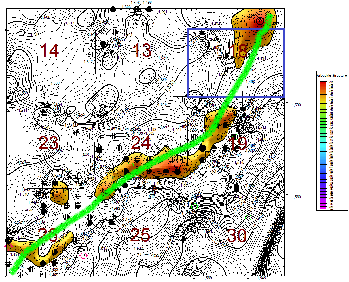

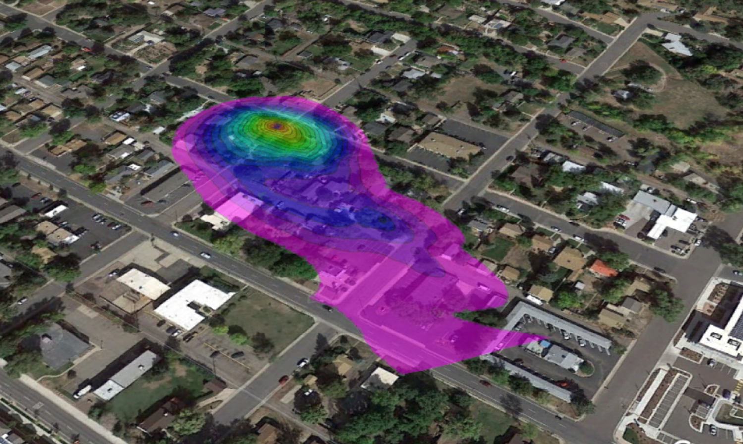
Display RockWorks graphic output in its built-in 2D and 3D viewing/editing windows, or export to CAD, Google Earth, and other GIS programs. Use the ReportWorks module to create page layouts for reports and posters.
RockWorks17 is offered with three feature levels so you can buy just the program tools you need:
- Basic: All Utilities programs, plus Borehole Manager maps, logs, log sections.
- Standard: All Basic level tools, plus Borehole Manager modeling: lithology, stratigraphy, geophysical/geochemical/geotechnical, aquifers, colors, fractures
- Advanced: All Standard level tools, plus SQL-server database support, program automation (scripting), 3D faulting, Borehole Manager petroleum production diagrams.
New in RockWorks 17: 64-bit, multi-threading, more robust databases, 3D faulting and more!
- 64-bit Processing for Larger, Higher Resolution Models:
RockWorks 17 has been completely rewritten to use 64-bit memory addressing to take advantage of much more RAM than ever before.
Eliminate the “Out of Memory” error messages when calculating or displaying large models. RockWorks 17 breaks the 32-bit limitation to provide access to 128 GB – 2 TB of RAM (subject to Windows and computer hardware capabilities). - Bigger, Faster, Better with Multi-Threading:
RockWorks 17 uses multi-threading to zip through calculations of large models. Use all the CPU cores on your computer to speed up your model calculations and display. - New 3D Faulting for Grid and Solid Models (RockWorks Advanced only):
Define a 3D fault ribbon with dips and dip directions at XYZ points, then use the fault ribbon as a barrier for 2D gridding and 3D solid modeling.Embed the faults within the RwGrd and RwMod files. - Use QuickMap for Borehole Locations:
The new QuickMap tab provides a quick look at all the boreholes in your project. Quickly “know your data” with a visual display of borehole spacing and distribution. - Sub-Sites:
Create sub-sites within larger projects for quick selection of boreholes and loading of sub-site dimensions. - Oil and Gas Production Data (RockWorks Advanced only):
A new Production table has been added to the RockWorks17 database for storing well production data by date and for generating a variety of graphs: Average Daily Oil Production, Cumulative Oil Production, Average Daily Gas BTU, etc. - Mapping Tools:
Add existing RockPlot2D files as “overlays” on new maps being generated. - Animations and Other Tools:
Easy-to-use Grid Morph program – add dates and go directly to video animation.
Redesigned PicShow program for easier animation and movies. - Grid (Surface) Tools:
Grids -> Section program: just like Grids -> Profile but for multi-point sections
Grids -> Groundwater Vistas Matrix: Transfer layer elevation data to Groundwater Vistas
New grid filters – replace node values with the closest values in the datasheet.
Copy faults from one grid to another
New grid smoothing tools - Group Solid Components with the New GeoBody Filter:
Specify a G value and tolerance to create a new solid model grouping similar values in a new model. Optionally create top and bottom grid surfaces defining the new GeoBody. - Other Solid Model Tools:
Use RockWorks lithology models to define zones in Groundwater Vistas
Use RockWorks block models to define matrix properties in Groundwater Vistas
Clip a solid model with multiple polygons stored in a RockPlot2D map - Google Earth Tools:
New “Billboards” have been added to several menus (T-Data, Aquifer, Production), for display of charts in Google Earth. - Native SQLite Database Support:
RockWorks 17 advances its database support by moving to native SQLite database support. SQL Server continues to be supported.
SQLite is an in-process library that implements a self-contained, serverless, zero-configuration, transactional SQL database engine. SQLite is an embedded SQL database engine. Unlike most other SQL databases, SQLite does not have a separate server process; it reads and writes directly to ordinary disk files. A complete SQL database with multiple tables, indices, triggers, and views, is contained in a single disk file. SQLite responds gracefully to memory allocation failures and disk I/O errors. Transactions are ACID* even if interrupted by system crashes or power failures.*ACID: Atomicity, Consistency, Isolation, Durability - Compact or Expanded Displays:
Keep track of your project dimensions and coordinates without crowding out your other data. Dimensions and coordinates can be displayed in a compact mode at the top of the RockWorks 17 window, or expanded out for editing. - Data Tools:
Enter your own SQL queries in the Borehole Manager’s View | Select Boreholes and Filter Boreholes programs
Warnings for zero-depth boreholes.
Export project tables from the database to the datasheet (section locations, etc.)
Fill blank cells in the datasheet with numbers based on the values in columns on either side of the blank cell.
Disable rows in the Utilities datasheet based on distance from boreholes in the database. - RCL – RockWare Command Language (RockWorks Advanced only):
Add sounds (bass note, car horn, drop chord) to scripts to alert you of progress or completion points. - System Tools:
RockWorks17 Help system is now on the web, with an option to download it (and link to it) locally for when you’re in the field.
Adjust menu font sizes.

Reviews
There are no reviews yet.